

The Cape Wrath Trail is a long-distance hiking route in Scotland. It links Fort William with Cape Wrath, the farthest northwest point of the British mainland. Renowned as one of the toughest long-distance walks in the UK, it is not waymarked, has no single recognised route, and there is frequently no actual path underfoot. Due to its informal nature, the length of this trail varies. Most thru-hikes are around 230 miles in length.
My hike of the Cape Wrath Trail took place between June the 3rd and June the 22nd 2015, and consisted of eighteen days of walking and two rest days. My route was 241 miles in length and was based on the itinerary laid out in the popular Cicerone guide by Iain Harper, with a few small modifications. I used the new Harvey Cape Wrath Trail maps for navigation.
The CWT is one of the finest foot journeys of its kind in the UK and takes the hiker through some magnificent wild locations. Its tough and frequently trackless nature makes the route I took potentially tricky in poor weather, requiring good navigational skills, a high level of fitness, and the ability to cope with hazards such as the crossing of swift-flowing rivers. But it's also truly magnificent. In this series of blog posts I will tell the story of my CWT adventure.
The Cape Wrath Trail trip report series
DAYS 11 – 14
TRAIL MILE 115 – 167
Day 11 – June the 13th
18 miles
 |
| Leaving Kinlochewe |
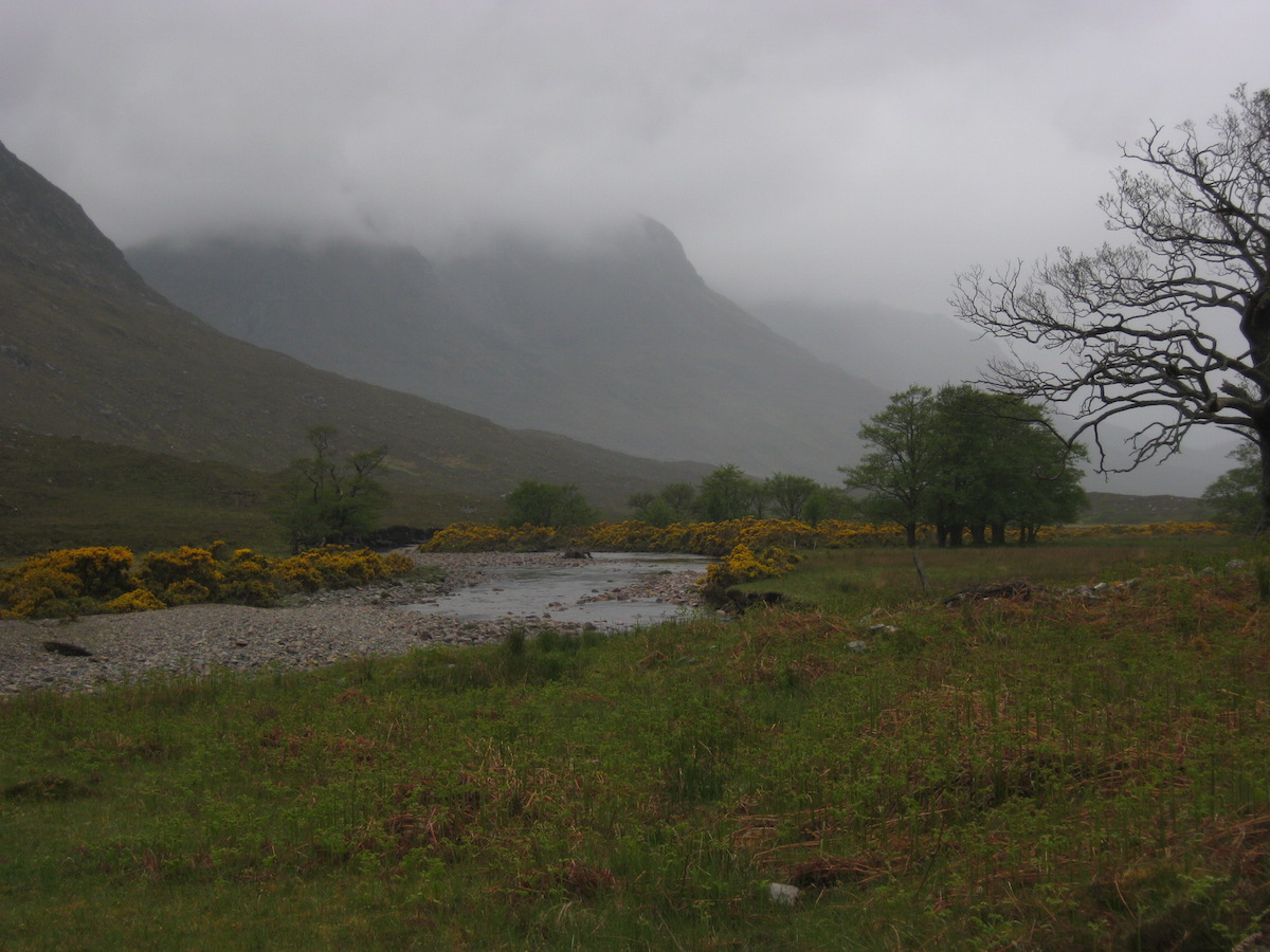
I left Kinlochewe early that morning, keen to make it across the wildernesses of Letterewe and Fisherfield to the bothy of Shenavall. Ever since I'd known what a bothy was, Shenavall had intrigued me – it's a remote shelter beneath the celebrated mountain An Teallach, and the focus of numerous stories and legends from 20th century mountaineering culture. It's one of those places with the glamour of magic about it.
But in order to get there I had to cross a big stretch of very remote and very wild land. The first section of the walk began easily enough, and for miles I strolled along flat landrover tracks that led from the village to the Heights of Kinlochewe, a tiny settlement at a fork in the track. I then followed similarly easy paths along the length of Gleann na Muice.
 |
| Easy walking for the first few miles |
 |
| Regenerating forest near the Heights of Kinlochewe |
The trail may not have been as obviously exciting as the rollercoaster ride of Torridon, but I enjoyed this stretch. Easy paths underfoot allowed me to increase my pace, and the regenerating native woodland made a pleasant environment to walk through. The weather had definitely deteriorated, though – rain fell intermittently for the first couple of hours, and when I left the good paths and began the inevitable section of trackless cross-country navigation, cold winds and mists blew in from the north. The skies grew dark and stormy. A torrential downpour seemed imminent.
 |
| The Letterewe wilderness |
Getting from the end of the path at Loch an Sgeireach to the Strath na Sealga involved navigating the pass of Bealach na Croise. The terrain was not particularly steep or rocky, but navigation proved to be a little tricky in the foul weather and I ended up wishing I had taken a compass bearing from the start. Something about the contour lines deceived my (usually excellent) sense of direction and I ended up on the wrong side of a small lochan, convinced I was facing north instead of east! I knew something was up when the terrain ahead didn't look as it should, however, and a glance at the compass set me back on course.
More contouring – I was getting good at that technique! – took me to the summit of the pass, but not before some truly monstrous peat hags had to be dealt with. On one occasion I found myself staring down a vertical bank of peat nearly ten feet high. Several lengthy diversions to avoid this and similar obstacles made the crossing of this pass take longer than expected.
On the other side of the pass, I started to follow a vague stalker's path on the left bank of a burn. It went the right way to begin with but after about half a mile I realised it was not descending, and I was at risk of contouring into one of the high corries of Mullach Coire Mhic Fhearchair – not at all where I wanted to be. So I abandoned the path and set a bearing for the river, splashing through the endless bogs and peat.
 |
| A very easy river crossing |
The river crossing was trivial (the water didn't come far above my ankles) and I soon found myself standing on a path once again. The weather was poor by this point so I was pretty glad that the off-path section of that day's trail was at an end. All I had to do was follow the path north and it would take me to the Shenavall bothy.
It was, however, pretty rough as paths go: continuously waterlogged, often ploughing straight through massive bogs or eroded areas of peat. At times progress was so laborious that it was better to climb a little way up the hillside and traverse rough heather and scree. I started to realise that the arid conditions between Bendronaig Lodge and Kinlochewe had spoiled me a little! This was back to how things had been in Knoydart, without the complex topography and killer river crossings.
But I felt cheerful. I wasn't on the CWT for it to be easy. I wanted a challenge – if I had wanted easy walking on nice paths I would have done the West Highland Way. So I made what progress I could and I enjoyed the splendid, beautiful desolation of my surroundings.
 |
| The Strath na Sealga |
Soon enough the path joined another glen, the Strath na Sealga, where I started to notice evidence of human habitation (albeit none recent). There were stands of ancient trees that may once have been an orchard, a ruined cottage, and tumbledown stone enclosures near the riverbanks. In better weather that place would have been a paradise, actually – but the driving rain kept me walking on as fast as possible instead of standing for a while and taking in the view.
For the first time on the trail, I saw other lightweight backpackers. Someone had pitched a Trailstar in a sheltered spot by the river, several Hilleberg Aktos were standing amongst the dead oaks of the wood, and I saw another lightweight shelter I couldn't identify a little further up the glen. I had seen no other walkers all day; it seemed strange to see so many others now. I started to wonder if maybe the bothy was already full.
I didn't glimpse the bothy until I was almost upon it. This haven in the wild nestles beneath the buttresses of An Teallach, and from first glance it struck me as one of the most welcoming bothies I had ever visited. It's the only intact building amongst a number of ruins (another tent was pitched, weirdly, within the walls of one of them) and I increased my pace, eager to get warm and dry in front of the fire.
 |
| Shenavall, the legendary home in the wild |
 |
| This was taken the following morning before departure |
I needn't have worried that the bothy would be full. It's pretty big as bothies go. One other person was in residence – Martha, a section hiker doing the CWT between Achnasheen and the Cape – but others soon turned up, and before long we had a fire and a merry gathering in the common room.
It was a classic bothy evening. Altogether the company included four hillwalkers just down from the Fisherfield Six, two down from An Teallach, Martha the section hiker, and myself. Two different single malt whiskies were doing the rounds and we all chatted about mountains and mountaineering while our socks and shoes dried in front of the fire.
Martha and I compared notes on the trail. Although her planned route was very different to mine, we were both aiming to finish on about the same day and I wondered if I would see her again on my travels. I hadn't seen any other CWT hikers for nearly a week and I had started to miss the social aspect of the trail – the sharing of plans and ambitions, the telling of tales at each meeting. I'd had to make do with reading entries in the bothy books as I'd passed, but more and more names I had followed from bothy to bothy were starting to disappear as I moved north. I didn't know if they had left the trail or simply gone a different way. Hiking alone is great but I also found I enjoyed being a part of the nebulous CWT community.
At about 10 p.m. the rain finally cleared, allowing the sunset to pierce the bottom layers of the clouds for a few glorious minutes – just long enough for me to run outside with my camera.
 |
| Alpenglow on the mountains |
 |
| The only sunshine I'd seen all day |
It had been a good day – tough in sections, but worthwhile. And I'd passed the halfway mark on my journey.
Day 12 – June the 14th
18 miles
18 miles
I woke late that morning as my original plan was to walk the nine miles or so to Inverlael, then camp before tackling the road walk to Ullapool. By the time I got up the bothy was almost empty. Wood smoke still curled from the dying remains of the fire from the night before. I looked out of the window and saw glorious sunshine.
I had breakfast with Stephen, a Scottish hillwalker who had camped nearby the previous night but decided to move his things into the bothy before tackling An Teallach. When we chatted about our adventures he seemed incredulous that I had hiked over a hundred and thirty miles with a small pack and lightweight running shoes – it was simply outside his experience. His own pack was an 80-litre monster that I tried and failed to lift onto my shoulders. He said it had weighed 24kg before loading it with food and supplies!
As we talked, another hiker arrived at the bothy, also on his way to An Teallach. The newcomer was an American called Jamie, and in the conversation that followed a momentous event occurred: I was given my trail name!
Trail names are not commonly used in the UK but they are established on the long American hiking routes such as the Appalachian and Pacific Crest Trails. A trail name is essentially a nickname that you can either pick yourself or (more often) is given to you and 'sticks'. I'd simply been introducing myself as Alex to everyone I met on the trail but I had secretly wondered if I would acquire a trail name before completing the CWT.
This is what happened.
Stephen: 'This lad has walked all the way from Fort William wi' nae boots.'
Jamie: 'No boots?'
Stephen: 'Aye, just these flimsy trainers. Nae boots.'
Jamie, looking at me: 'That should be your trail name, man. Naeboots.'
And so it was that my trail name became Naeboots! I didn't use it in person on the CWT – it would have felt weird – but I signed off my name as Naeboots in every bothy book from that point onwards. And, if I ever hike in the USA, that's what I'll call myself.
I soon packed and left the bothy, ascending behind An Teallach to an elevation of 400m. The views were absolutely stunning – and they remained that way for the entire day.
 |
| The view back to the Fisherfield wilderness |
The route from Shenavall to the main road at Inverlael went over two passes: the first beneath An Teallach to Dundonell, the second over wilder moorland at a similar elevation. I enjoyed both passes tremendously. The first was wooded and ridiculously scenic, like a small portion of the Alps dropped into Scotland; the second was the usual combination of wide open spaces and endless bog/peat, but the views more than made up for it. And I was making good time.

 |
| The CWT descending to Dundonell |
 |
| An Teallach |
The views of An Teallach were stunning and a true highlight of the entire trail. I thought to myself that this is what all Scottish mountains should look like, clothed in trees and green nature, not stripped to the bone by millennia of human interference and devastated ecosystems.
 |
| Uncharacteristically lush countryside on the second pass |
 |
| The crest of the second pass – spot the walkers |
The descent to Inverlael was relentlessly steep and I was glad of my trekking poles as I slithered down muddy logging tracks. The views ahead were, again, gorgeous.
 |
| Inverlael |
It was early in the afternoon when I got to Inverlael, so I saw no need to camp. I set off north along the main road to Ullapool. This stretch of road is only about eight miles long, but in the heat and traffic it actually felt much longer. The guidebook recommends against tackling this roadwalk, except if you're a purist, but I had to resupply in Ullapool and was determined to walk every step of the way to Cape Wrath. Hitching or finding a bus was not an option!
So I walked. After a couple of miles my feet began to hurt, and I stopped to have a look at them. To my surprise, both shoes had developed serious holes in the uppers – and, worse still, the rubber had worn alarmingly thin underneath the balls of my feet, with a few lugs worn completely down. The cushioning had also collapsed there. I started to wonder if my shoes would last the rest of the trail.
I was tired when I got to Ullapool, but the weather was sunny still and I found a sheltered pitch at the camping ground. The next day would be a zero.
Day 13 – June the 15th
Zero miles / rest day
Zero miles / rest day
There are worse places to spend a zero than Ullapool. It's a pleasant lochside town with every amenity the thru-hiker could wish for: supermarkets, pubs, restaurants, hardware stores, even a very good outdoor store. After buying supplies to last me to Kinlochbervie near the end of the trail, I made a visit to North West Outdoors in search of a new pair of running shoes.
Unfortunately they didn't stock Inov-8. The only lightweight mesh trail shoes they stocked were the Merrell All Out Peak. I didn't like the extra cushioning and flimsy mesh, but the fit felt ok so I bought them. Then I went to the post office and sent my Scarpa Spark shoes home (the Goretex shoes that had performed so poorly on the trail, and which I'd been lugging around as camp shoes ever since).
My strategy would be simple: wear the knackered Inov-8 shoes to destruction, then switch to the Merrells.
I ate well at the pub that day and spent time wandering around the town and exploring. It felt strange not to be hiking and, oddly, I felt more tired at the end of that day than I usually did after a day on the trail.
 |
| Ullapool |
Day 14 – June the 16th
16 miles
16 miles
My route from Ullapool was not actually on the main CWT as described in the Iain Harper guide. It's presented as an alternative stage for hikers who chose to divert to Ullapool, and an easy stage before sterner stuff ahead. As I had no wish to walk or hitch back along the road to the main CWT route, I took the alternative stage via Glen Achall.
This was an easy stage, but also comparatively dull. Don't get me wrong, every day walking in the Highlands is better than a day spent at a desk, but I'd become used to hiking classic trails beneath legendary mountains, every mile a challenge and a pleasure. This was a long walk on landrover tracks through sheep farms and lowland estates. It was just one of those stages where you get your head down and walk.
The most exciting thing to happen all day was an off-path diversion to avoid a herd of cattle with calves on the advice of the farmer. I did, however, see large numbers of unusually tame deer very near to the road.

The weather remained dull and chilly as I walked. Gradually the terrain became less cultivated and more wild, and I made good time to Loch an Daimh. I spotted Knochdamph bothy and poked my nose in for a look, but found it creepy in the extreme – there was even an upstairs room with a rusty old Victorian bed still in situ!
The rain came down in buckets while I stopped in Knockdamph, so I took the opportunity to make some coffee and read the bothy book. Only a handful of CWT hikers had made entries.
But I wanted to get a few more miles in before I called it a day. I left Knockdamph in the rain and continued along the track, entering Glen Einig before long. Glen Einig reminded me of the Yorkshire Dales with its wide open sheep pasture and drystone walls.
The Schoolhouse bothy was my stop for the night (although as usual I arrived early – still getting the hang of the logistics of the CWT!) It's a quaint little building that once served as a schoolroom, but the MBA renovated it some years ago and it now serves as an open mountain shelter. There was no fireplace, but it was a very snug little building and one of the smartest bothies I've ever stayed in.
I read old copies of Wild Land News until it got dark, and went to sleep dreaming of wolves, forests and rewilding. The next day I would hike to Glen Oykel – a leg of the trail that looked easy on the map, but it proved to far more challenging than I expected in the deteriorating weather. Every day presents its own challenges on the Cape Wrath Trail!
This was an easy stage, but also comparatively dull. Don't get me wrong, every day walking in the Highlands is better than a day spent at a desk, but I'd become used to hiking classic trails beneath legendary mountains, every mile a challenge and a pleasure. This was a long walk on landrover tracks through sheep farms and lowland estates. It was just one of those stages where you get your head down and walk.
 |
| Typical Glen Achall scenery |

 |
| The glen becomes a little wilder |
 |
| The third worst bridge I encountered on the CWT |
 |
| Near Loch an Daimh |
But I wanted to get a few more miles in before I called it a day. I left Knockdamph in the rain and continued along the track, entering Glen Einig before long. Glen Einig reminded me of the Yorkshire Dales with its wide open sheep pasture and drystone walls.
 |
| Glen Einig |
 |
| The Schoolhouse – it has two rooms |
 |
| Expanding to fill the available space |
The Cape Wrath Trail trip report series
No comments:
Post a Comment